Quickly Identify Disclosable Buildings
Updated December 16, 2024 with 2023 CEC Data
CalWEP and the California Data Collaborative (CaDC) have partnered to provide an easy solution for water agencies to comply with the disclosable buildings requirement of the “Making Conservation a California Way of Life” regulation. The regulation requires water suppliers to identify all disclosable buildings within their service area by the effective date of the regulation, which is expected to be January 1, 2025. Agencies must use the list provided by the California Energy Commission. Upon request from building owners or their agents, agencies must provide the last four characters of the meter serial number and the aggregate water use data in monthly intervals for each meter. Specific details can be found in the full regulatory text here.
Our toolkit offers member agencies an efficient way to identify these buildings with ease and confidence.
Key Features:
- Downloadable Excel Document: Access a ready-to-use Excel file containing the current list of all disclosable buildings within each water agency’s boundary. Agencies can quickly filter by their name to obtain their specific disclosable building data.
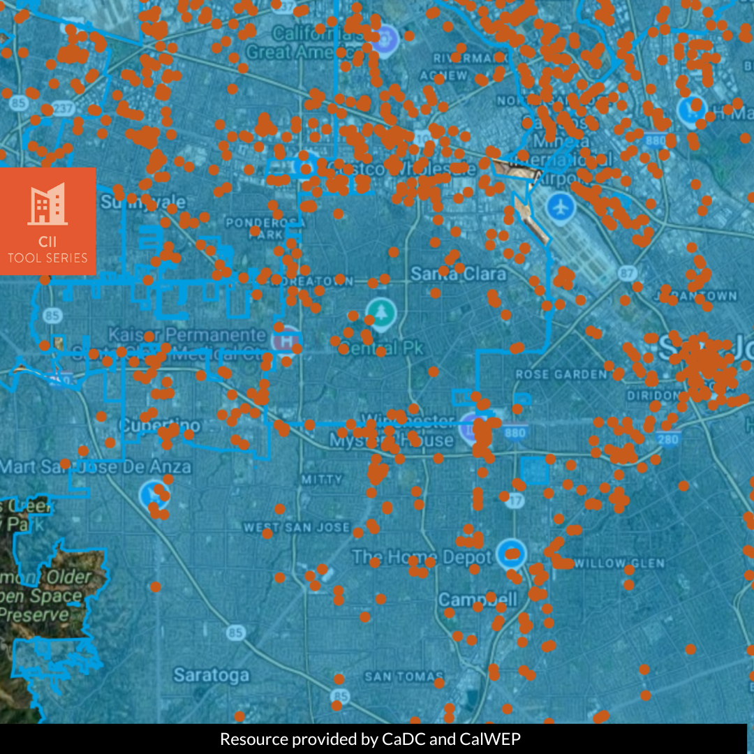
- GIS Mapping Application: An agency can visualize its service area’s disclosable buildings with our innovative GIS application. This tool maps each building to urban water supplier boundaries, providing a clear, visual representation that enhances data quality and accuracy checks (QA/QC).
With this toolkit, your agency can fulfill the regulatory requirements around the identification of disclosable buildings, saving time and simplifying compliance.
Source Data: 2023 CEC list of disclosable buildings, Supplier Boundary Data
DISCLAIMER #1: At the end of the excel list are approximately 500 buildings that do not fall within any urban water supplier’s service area or are missing geocodes in the source data. Please check any unassigned buildings to evaluate if they are within your service area.
DISCLAIMER #2: If a building is in a location covered by two different service areas, it will appear twice in this excel file – once for each supplier boundary that overlaps it. Suppliers should look at their service area on the GIS mapping application, especially around the edges, to determine if the property should be included in their data set.

